After four years, our community once again has a brand new Sanctuary! From the provenance of the beams to the benches to the barrels, there are many significant stories to tell – and the Findhorn Hinterland Trust played an important role every step of the way.
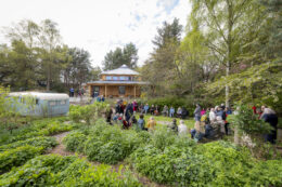
Light of Findhorn Sanctuary Photo: Mark Richards
Easter Sunday, 20 April 2025 – the day the new sanctuary was completed and opened for the first time – was significant for the whole community at the Park Ecovillage Findhorn and beyond. This project and building has become a symbol of hope and renewal to many. The FHT is proud to have been involved in this community project and I want to take a moment to reflect on all that our land, members, benefactors and volunteer team have contributed to over the past four years.
On 13 April 2021 the fires, an act of arson, ravished and totally destroyed the old sanctuary that had been providing a place to gather and enjoy peace and spiritual sustenance for over 53 years.
FHT had started clearing a site for the Conservation Hub that January, and by February a team of people were stripping bark off poles in the snow for its construction. In September of that year the foundations went in and on 19 February 2022 it was finally completed and we celebrated its opening.
The Hub building was important for the charity as it gave us a number of things that encouraged us to get involved in the sanctuary build: confidence and skills to prepare and use round wood in construction, particularly aided by Henry Fosbrooke, a master in the art, and Sean Brechin who oversaw the Hub build; links with local timber miller Ben Moore, who brought in his portable mill to produce construction timber; and our hard work and achievement attracted the attention of a couple of important funders, including the Hygeia Foundation and a generous community member who remained anonymous. This donation of over £3000 helped pay for the subsequent work the charity undertook on the sanctuary.
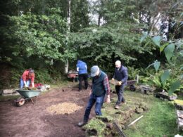
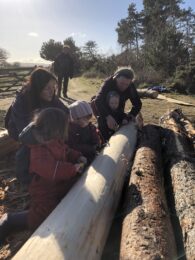 FHT is a great believer in never making a good catastrophe go to waste! That’s what happened when storm Arwen struck on the 25 November 2021, resulting in over one hundred trees in Wilkies Wood being blown down. Our Land Manager, Kajedo, set to work felling the trees and I pulled them out using our wee grey Fergie tractor. They were to be either milled by Ben then stacked and covered by FHT volunteers, or stripped, covered and stored as round construction wood by a merry band of young and old within our community.
Much of this was done before the Sanctuary design was finalised, during a design charette event around the 20th March 2022. Hinterland prepared timber was going to be used for the main round columns and beams of the new structure and some of the cut wood for roof sarking.
A number of the Scots Pine trees had been planted in the early 1960s by my father in what became the Wild Garden. The intense sanctuary fires had left them cooked and burnt inside, so on 17 March 2022 they were felled and our tractor again removed them. Two of the lengths were subsequently used to make up a portion of the five main beams of the sanctuary structure. The rest of the trees were milled by Ben for the Findhorn Foundation gardeners and they lay seasoning outside the garden tool shed. In the week of 24 November 2024 they were converted into benches for the new sanctuary’s vestibule and sitting-out area (a sitooterie in Scots!) – you can read about the benches here. They were moved to the sanctuary on 25 January 2025 and subsequently installed along with the coat hook panels on 2 February.
Back in the autumn of 2022 FHT got involved with its own volunteers and equipment, along with the Findhorn Foundation gardeners, in clearing the sanctuary site. The landscaping rocks were going to be recycled when needed for the new building, we cleared the plants and trees, including a half-burnt apple tree that was dug up and replanted successfully in the new Woodside garden.
 By November we were starting to remove the wooden sheds that had become important and well-used offices as the community grew in the 1970s and 80s, and were still in operation before the fires. First to go was the cooks office on 8 November, the computer office on 10 November and finally the Park Campus office on 2 February 2023. The General Office and food shed were finally removed by the site contractor’s machines on 5 October 2023, after many years of faithful service to the community.
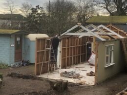
We tried to recycle everything we could from these buildings, being particularly successful with the computer office. This was completely rotten at the base but otherwise in fair condition. Before taking it apart we measured it and it just happened to fit almost exactly the metal trailer frame with an insulated floor we had prepared back in April 2022. So we cut the rotten studs at the base and had Ruari and Jason of Greenleaf Design and Build get in their machine to physically pick it up and set it on the base. 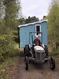 Almost instantly we had a shepherd’s hut to be used for FHT long-term volunteers on the land! After installing a wood stove and covered verandah, as well as repainting and re-roofing it back at the Conservation Hub, we moved it into Wilkies Wood on 28 April 2023 and had the grand opening as part of that year’s May Day celebrations.
Also in autumn 2022, after the site had been marked out by the surveyor on 28 October, we selected and cut poles in Wilkies Wood and erected them on the sanctuary site, strung together with ropes to physically show everyone the dimensions of the new building. This basic 3D model was appreciated during the large gathering of community members on the site for a blessing as part of the 60th community birthday celebrations on 17 November 2022.
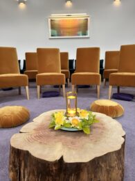 Another FHT contribution was to remove a large redwood tree that was beginning to threaten Cornelia Featherstone’s house situated on the way up to the Universal Hall. It had been felled by a local tree surgeon, after permission had reluctantly been given, helped by the intention to use the wood as part of the new sanctuary build. The logs that were removed in March 2023 have yet to be converted to furniture, but the remaining stump had a 20cm section cut off and sanded – it is now the centerpiece for candles and flowers in the new sanctuary. It looks and feels so appropriate that the tree is honoured in this way.
 A now unseen but significant effort by FHT volunteers was helping to dig the large soakaway for the building. This involved taking up the turf on most of the original garden lawn, stacking it out of the way for the digger to come in and create a huge hole, which was then filled with gravel before the turf was re laid. At this time, a midden of shells and burnt wood was discovered when digging the sanctuary foundations. I informed archaeologist Michael Sharpe – you can read about this find here.
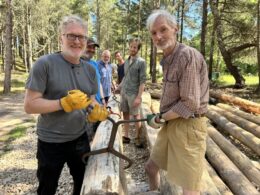 It wasn’t until 23 April 2024 that the building foundations were dug and the concrete poured on 26 April. In June the selected structural poles, which had been stored in anticipation of the build, were moved down to the FHT Conservation Hub for final preparation, before they were moved to site and and erected in September. We also used the tractor to deliver sarking stored up in Wilkies Wood that was used in the roof.
The final act was the landscaping – bringing the new building into harmony with the original caravan, the large cleared area where the former shed offices had been, and the original garden. Some of the milled wood was moved onto site and a group of FHT volunteers used it to create a small fence to protect the seeded grass area. Rocks that had been stored up at the wind turbines had to be selected and loaded onto the tractor to be transported and carried onto site, to be crafted into walls or edging. Topsoil, gravel and mulching material had to be wheelbarrowed into position. Most of this I did myself as an act of connection and love for this place where I grew up. I was born in the original caravan before it was moved to where it sits now, and I lived there from the age of six – with my two brothers, mother, father and friend Dorothy Maclea – for seven years, seeing and living off the expanding garden that became so important as a ray of hope to the world.
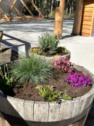
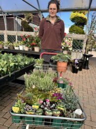 It was special to go to Greens Nursery in Nairn on 9 April 2025 and take time to select the plants to enhance the building and surroundings. Long-term community member John Willorner and I had asked if we could collect a few of the whisky barrel planters from Cluny Hill Hotel, as a symbolic connection to this place that had housed thousands of guests for the community since it was bought in 1975. We loaded them onto the Findhorn Foundation bus along with the soil. By the time they were looking magnificent with the new plants in them, Cluny had been sold after 50 years of community service – we were glad we had taken time to gather this small memento.
 Recently I heard a long-term community member say it was such a pity that people could not get involved in the building of the sanctuary, as had been the case in the 1970s with the Universal Hall. I was wondering where they were when the call for help went out! I am personally satisfied with what the charity has been able to offer our local community and very pleased that we could fulfil one of our charitable purposes, which is to help build local community, in this way.
Jonathan Caddy
FHT Chair
20 May 2025
 From bare dunes and a caravan park to a rich natural treasure – the stories of nature, ecology and biodiversity at Ecovillage Findhorn have now been compiled into one comprehensive feature.
  It is one of a series of topics relating to environmental and sustainability themes at Ecovillage Findhorn.
 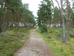 The purchase of the adjoining Wilkie Estate in 1997 led to the beginning of a new phase of working with nature at the Ecovillage, focused more on land management and biodiversity. The Findhorn Hinterland Trust was established and became a charity in 2015, with one of its main aims being to promote environmental protection and improvement.
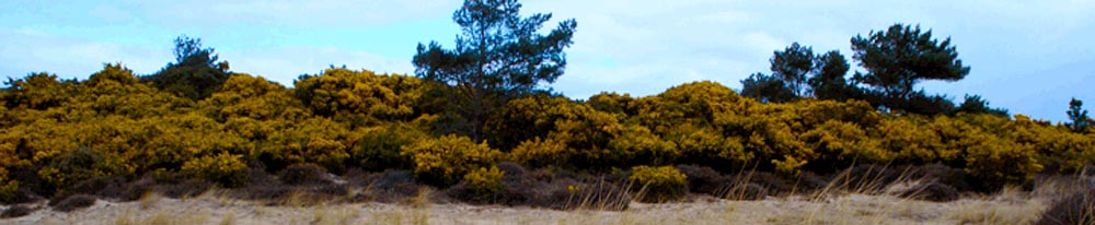
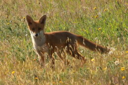
 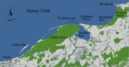 The Findhorn Dunes are a moving miracle, showcasing nature’s awe-inspiring cycles and telling an epic historical story – from neolithic artefacts, natural disasters in 1694 and 1703, to a 1930s golf course now hidden by time.
  Our Land Manager, Kajedo Wanderer, shares news of a Vision Quest held recently in the Hinterland, and the importance of being still and listening to the land.
 Later ‘Permaculture’ affirmed the guidance to be still and listen, through its governing principle of (before you change anything in the natural world) ‘observe, observe, observe’.
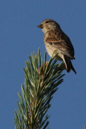
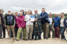 The Findhorn Hinterland has become one of the country’s first to receive official recognition as a Nature30 site, part of a global movement to ensure that by 2030 at least 30% of the planet is effectively protected or conserved for nature.
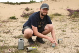
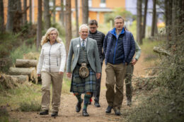 The result was an award ceremony that took place at our Conservation Hub and on the new dune created as part of the Dune Restoration Project. It involved a visit from the Cabinet Secretary for Climate Change and Energy, Gillian Martin, and Nick Halfhide, CEO of Nature Scot, the Scottish government nature conservation organisation, along with their 30 by 30 team based in Inverness that had been developing the project.
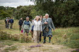 Additional information followed saying the Nature30 recognition is designed to help Scotland achieve the 30 by 30 target by celebrating and supporting land management that does and will continue to deliver great long-term outcomes for nature and people. It will be achieved through a combination of new and existing Protected Areas as well as this new Nature30 recognition.
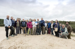 Jonathan Caddy
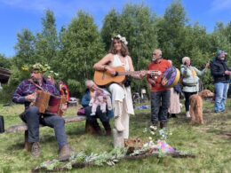
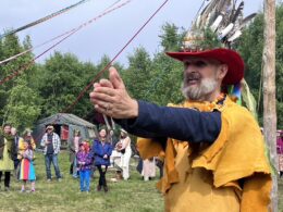
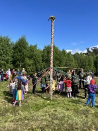 In May the the Hinterland saw the Ecovillage Findhorn community celebrating the Celtic festival of Beltane with a traditional weaving of the Maypole, led by Scottish Greens councillor and FHT member, Draeyk van der Horn.
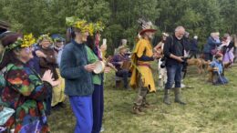
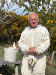
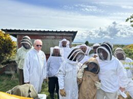 Opportunities for visitors to get involved in our regular Thursday morning (10am to 12.30pm) bee inspections are just one of the things we will be offering as part of the
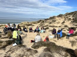 Another
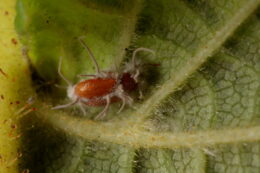
 Findhorn’s sand dunes were once part of the second largest dune system in the whole of Europe, but now only very small fragments of that wild ecosystem remain. Because the Hinterland is such a small fragment of a very scarce ecosystem, we have created a conservation plan to preserve and nourish this special environment and all the species that still survive here. The plan is called a Local Biodiversity Action Plan (LBAP), and for me personally, it helped me appreciate just how many rare and endangered species we have on our doorstep. Do have a look at it on the Trust’s
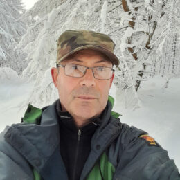


Chair’s Report – Summer/Autumn 2025
FHT Chair Jonathan Caddy with Cabinet Secretary for Climate Change and Energy, Gillian Martin
Findhorn Hinterland Trust chair Jonathan Caddy shares news on an extremely busy Summer, as well as some impressive legacies as he steps down as FHT chair in September 2025:
It feels strange knowing that this will be the last Chair’s report that I will be writing as I step down at the FHT AGM on the 18th of September, when the long-planned restructuring of the charity will come into effect. Colin Shreenan will become the new Chair and his wife Laura will hold the paid position of Whole Team Coordinator. A new Education and Community Team is in the process of being formed to ensure the education and community purposes of the charity are more fully developed, and I will be staying on as a trustee and will be the Team Lead for that aspect of the charity’s work.
All these changes are to ensure that the charity is structured to remain sustainable and resilient well into the future. For those interested I will write another article in the next edition explaining the charity’s new form more fully. I am also sharing this in a ‘Sunday Slot’ session on the 7th September. It is a big change for me as I have been Chair since the charity’s inception in 2015 and was instrumental in forming and developing its precursor, the Findhorn Hinterland Group, over the previous 10 years. It has been a rich and fulfilling journey, worth an article in its own right in the next edition.
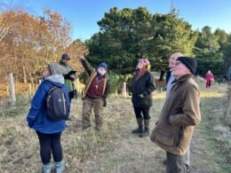
We have still not fully cleared up after the storm as it coincided with Kajedo, our Land Manager, slipping and breaking a couple of ribs – ouch! This gave me the opportunity to refresh giving Hinterland tours of the land with guests and also to hold more of the volunteers that Kajedo usually works with. Thankfully he was still able to coordinate the German Vision Quest group that was with us for two weeks at the end of August (see News from the Land). It made me appreciate once again how much he does and holds as a guardian of the land – thank you Kajedo!
Other activities included nature awareness games with Roy Simpson and helpers, conservation work with Neil Meikleham and George Paul, pulling up tree seedlings on rare dune heath areas of Findhorn Dunes Trust land, helped by FDT Chair Steve Worth, and Andy Goldsworthy inspired art projects on the beach from found materials with two of the school Art teachers.
The other partnership we have been developing this year has been with the Guest Services wing of the Findhorn Bay Holiday Park. It has taken considerable time for their Manager, John MacPherson, to set up a new tent booking system for our camp pads and for us to set up a monthly calendar with a series of activities connected to the land for guests to enjoy, but they are now there for next season. Hopefully more people will get a chance to enjoy connecting with the land in these ways and in the long run it will also help bring in funds to help pay for the good work that we do.
We have recently been successful with funding through other grants. A Neighbourhood Ecosystem Fund grant from Inspiring Scotland brought in £13,500, which is being used to fund a new 10-year Local Biodiversity Action Plan being written up by ecologist Sean Reed as well as a major study by the James Hutton Institute in Aberdeen of beetles and other invertebrates on the land. The latter involves about 40 pitfall traps being placed in different areas but particularly on the new Dune Restoration Project (DRP) site from July to October. These will record what inhabits our land and if rare dune species are starting to colonise the areas of bare sand created through this project.
Other funding has been £2000 granted through the Moray Climate Action Network Seed Fund, which will be used for the Dune Restoration Project work to be carried out this coming November – creating new bare sand in the fire pit area within the settlement, mulching gorse next to the previously created sand areas to allow the natural process of wind to blow sand into these areas, and the clearing of gorse from an area close to the wind turbines that we are earmarking for an extension of the green burial ground.
Finally the FHT is becoming involved in the process of helping distribute the remaining assets of the Findhorn Foundation Trust (FFT) as it winds up. FHT is one of its legacy charities, along with the Park Ecovillage Trust, Ecovillage Findhorn CBS, the Findhorn Foundation SCIO and Ekopia as an asset-locked community benefit society. FFT has appointed a consultant firm to help the organisations work out how best to carry out this task for the Park Ecovillage Findhorn community, and it will be interesting to see what comes out of this process for all organisations, but particularly the FHT. Colin and I will be representing the FHT during this time, with the aim of having decisions made by the community birthday on the 17th of November.
I think that is all from me now as Chair. My final word is to thank all the many hundreds of people who have been involved over the past 20 years in making the lasting achievements of both the FHT and its precursor, the Findhorn Hinterland Group, possible. As a real team we have collectively made such a positive difference to both land and people over the years, helping open eyes and minds and honouring this beautiful part of the Earth we live next to. If all the World could take care and delight in getting to know and looking after their backyards as we have done, I believe it would be a far better and different place.
Jonathan Caddy
FHT Chair
1st September 2025